
VA 10 in 2010, I took the opportunity to clinch VA 31 in 2011. Since I was driving, Jamie and I shared the duty of taking pictures, something done spur-of-the-moment while trying to merge and take pictures at the same time on VA 321. The music chosen was an eclectic mix of styles: opening with DJ Shimamura's album SX (hardcore/rave breaks), followed by Feed Me's Big Adventure (electro house/dubstep), then Daft Punk's Tron: Legacy soundtrack (ambient/electro) and concluding with Radiohead's The King Of Limbs (alternative/experimental).
VA 5 winds through Charles City County, mostly through a forest. In the areas of Berkley and Westover Plantations, the road comes into the open for awhile. The bike path to the right runs from the Kimages area to Charles City courthouse.

Looking at a farmhouse to the north of VA 5. Charles City County has a lot of open land, but none for sale.

Another farmhouse.

By the time we reached Charles City Courthouse and VA 155, the bike path had ended.


I'm not sure what was going on here, but it looked like they were sure having fun.

This is what the majority of VA 5 looks like outside Richmond and Williamsburg.

VA 5 uses this bridge over the Chickahominy River between Charles City and James City counties. It's only a couple years old. Before that it used a bridge that was much closer to the water and had a height restriction. I think it was a drawbridge but I don't think I ever actually drove on it.


The bike path returns past the bridge, criss-crossing VA 5 up until SR 5000.
Now in James City County, at the intersection of VA 5 and SR 5000, which was posted as SR 5000 Truck for some reason. Either way it should be VA 321.

SR 614 is a north-south road on the west side of Williamsburg, going from US 60 in Lightfoot (which contains lots of shopping centers that, as I found out the hard way in 2010, are extremely busy all the time) to VA 31/359 near the Jamestown Ferry. Here it begins a brief duplex with VA 5.

From here I followed VA 5 to SR 615 Ironbound Road, looking for a VA 5 cutout shield last seen in 2004. It's been replaced with some rather large VA 5 shields that I missed.
Ironbound Road is no longer continuous, as the VA 199-321 interchange was built in its way. Thus, one must turn here at SR 613 (News Rd) and use VA 321 across VA 199 to continue on Ironbound.

VA 321's west end is here, transitioning to SR 5000. While the transition is clearly marked, I still think it should all be VA 321.

A trio of VA 199 trailblazers on eastbound VA 321. VA 199 is sort of like a beltway around Williamsburg, but it's actually an expressway.

LGS VA 321 reassurance shield. I nearly missed this trying to merge, and I did miss a standard black one just past where 321 begins. Therefore, I handed the camera to Jamie and focused on driving.

LGS trailblazers for VA 321 and SR 615, where Ironbound rejoins its old alignment, only to loop around and across VA 321 again later. The shields in these were almost certainly made in Williamsburg, as they use identical shields, but with a darker green backing as you'll see later.


This intersection is Ironbound again. It was under constrution like this in 2010, too. Ironbound proper is really bumpy between here and VA 322.

That's a shopping center. In a related story, this is very close to the William & Mary main campus.

From here I followed Ironbound north towards VA 322, where Ironbound turns right and goes into Williamsburg proper. It goes by another William & Mary complex, and connects VA 322 with US 60, so I believe the northeastern segment of Ironbound should be an extended VA 322. Since I took pictures of 322 in 2010, I didn't do so this time. I did take a picture of this US 60 unisign, however.

Double mast arm madness! I've never seen a pair of mast arms split directional traffic lights before. From here, we stopped and ate at the buffet KFC, seen in the background here.

When leaving KFC, I tried taking a picture of this Sunoco that was blatantly a Texaco not very long ago (with poor patching jobs done to it) but the sun glare killed it.

From here we headed towards the local Best Buy, where Jamie wanted to get a car charger so his phone wouldn't die. Here we approached US 60's intersection with VA 132. This is in York County, so standard black shields are used.


Continuing east on US 60 past VA 132, the speed limit drops from 45 to 35, once the road goes back into Williamsburg.

If you're following US 60 to Busch Gardens, you should be in the right lane. There are two of these assemblies, so a lot of people must have gotten lost trying to find it.


US 60 begins its wrong-way multiplex with VA 5 to the right here. You're actually going southbound this way.

Even though it took longer to get to Best Buy going through town instead of I-64, I did so because I wanted to see VA 162, which once ended at the traffic light second photo.


And here we are...behind these odd VA 143 trailblazers, at the city limits sign, is the west end of VA 162. The traffic light in the far background is its east end, at VA 143.

Despite its comically short length, VA 162 is fully posted, with a reassurance shield in each direction, and a 45 MPH speed limit (due to being the through movement at its intersection with VA 143).


VA 143 trailblazers at VA 162's west end. From here I continued eastbound on VA 143 towards VA 199. VA 143 was once part of VA 168 before I-64 came along, but that's for another post.

VA 143 parallels US 60 east of Williamsburg, so closely at some points that they're separated by just railroad tracks.

Various signage as VA 143 comes upon VA 199. Just east of here, on US 60, is Busch Gardens.


The only way to get to Busch Gardens from VA 143 is to use VA 199 and I-64, as these overheads of questionable quality denote.

The Marquis Center, or whatever it's called, is located on VA 199 east of I-64 and contains Best Buy, Target, Kohl's, and JCPenney, as well as these awful speed limit signs.

VA 199 is signed to continue past Water Country USA.

VA 199 ends at this intersection with Penniman Road (York SR 641), but I think it should continue east to the entrance of Cheatham Annex, like VA 206 does with the Dahlgren Naval Base.

From here I got on the Colonial Parkway (hereafter known as "the Parkway") and headed east towards Yorktown. This is what about half of the Parkway looks like, with an unmarked right of way and suicide lane. The parkway has the bizarre designation of VA 90003. I personally think it should be VA 359, with current VA 359 changed to either VA 359Y or 31Y.

The Parkway's bridge over King Creek.


Here's the bridge over Felgates Creek. Getting really close to the York River at this point.


The Parkway has a lot of Do Not Pass signs where they don't want you to pass. If they really don't want you to pass, they put them up on both sides of the roadway.

The view of the York River from the Parkway. Partially obscured by my face and car.


The Parkway has great views of the Coleman Bridge, which US 17 uses to cross the York River. There's a better view much closer to the bridge, but I didn't realize that until it was too late, and it's covered by trees westbound.

The Parkway has an exit with US 17 just before the latter route goes onto the Coleman Bridge.

The Parkway ends in Yorktown, but I continued on VA 238 for a bit before turning around. Here's where 238 turns towards Newport News.

Yorktown. This was once part of VA 238. The Parkway begins to the left.

Just west of Yorktown, the Parkway's interchange with US 17.

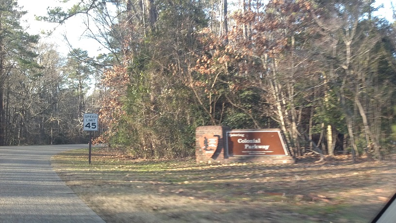
Entrance sign for the Parkway, which is maintained by the National Park Service.
When passing is permitted on the Parkway, the NPS tells you to Pass With Care.

This is now west of the Penniman interchange, going over an unmarked pond.

Leaving the Parkway at VA 132Y to refuel and find some, erm, facilities, there was this brown sign set that had standard shields for I-64, US 60, VA 31, and VA 5. VA 132 and VA 199 shields are absent, despite your having to use them to get to VA 31 from here. Either way, these are the only shields on the Parkway itself.

Standard black (unusual for Williamsburg) VA 132Y reassurance shield leaving the Parkway. VA 132Y is a short (though longer than VA 162) connector between VA 132 and the Parkway. It contains some visitor's centers and was briefly VA 132 in the 1950s.

Trailblazers for VA 132, I-64, and US 60 at the west end of VA 132Y. Conspicuously absent are trailblazers for VA 5 and VA 31 (both southbound).

Now back at the intersection of VA 132 and US 60. I went to a gas station downtown (and paid an arm and a leg for premium), but there was no public restroom, so we went through town to find one.

VA 5 reassurance shield on Lafayette Street. This was once part of VA 162 and VA 132 as well. VA 132 was rerouted to its current route when VA 162 took over in 1978. In 1994, VA 162 was removed from the city. Also, the railroad follows Lafayette closely here, as can be seen in the left of this photo.

VA 5 approaches the south end of its wrong-way multiplex with US 60. You know where I'm headed again.

Yes, I was headed back towards VA 162.

Those same VA 143 trailblazers. We stopped in a CVS near here.

When leaving CVS, I got into the wrong turn lane, so I crossed VA 143 into this strip mall which had a Dollar General and Dollar Tree right next to each other.

Heading down VA 162 westbound this time.

VA 162's westbound reassurance shield. The pavement change in the background is at the Williamsburg city limits, where VA 162 thus ends.

NO left turn. This is leaving the VA 5/US 60 wrong-way multiplex heading back towards the Parkway. We found it odd that "NO" was larger than the rest of it.

Blurry westbound VA 5 reassurance marker.

VA 5 approaching VA 132. They duplex south of this intersection.


Heading back to VA 132Y and the Parkway.


Just past VA 132Y on the Parkway is this tunnel, which goes underneath Colonial Williamsburg. The inside of the tunnel is the only point at which the Parkway looks like a "normal" road.


Getting closer to sunset now, the Parkway heads towards the James River and Jamestown.


The side T intersection signs on the Parkway had an unusually long side prong.

From here the Parkway ended at VA 359 (closed west of there) so we headed towards the Jamestown Ferry. The ferry was just leaving as we got there, so I had plenty of time to get out and take pictures.


Obligatory car photo. The BB2 handled the trip extremely well. There were several sports cars on the Parkway, like Porsches, Corvettes, and even an old Beetle, but mine was the only one from Japan.

The temperature was 56 degrees at 4:26 PM. It sure did feel colder with that wind and cloud cover.


More water photos.


Me, standing awkwardly in front of some random college girl's car on the docks. She just leaned her seat back and read a book the whole time.

Standing awkwardly in front of my own car this time. The ferry came just after this picture.

Sunset on the ferry. The boat we got this time was the Surry, which had no upper outside deck.


After the ferry, I drove through Surry to this fork, where I kept going south to clinch VA 31. This was the last sign photo that even remotely turned out, due to the incoming darkness. The sky was much darker than this photo indicates.

The sun sets over VA 31, and 2011 as well.

Up next, I show my favorite photos from 2011. Stay tuned.
No comments:
Post a Comment